Planning Review 2026
Espoo continues to grow, which creates needs for more housing, services, workplaces, and recreational opportunities for our residents. Planning guides sustainable growth through plan priorities and the master plan, which is in the preparation stage.
Planning ensures sufficient and diverse opportunities for housing construction. It also makes sure that people can get to schools, hobbies, shops and workplaces on foot, by bicycle or by public transport – and of course, in their own cars.
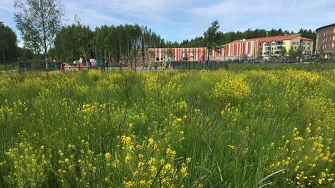
Another important objective of planning is to make sure that residents continue to have natural environments for recreation and to maintain our natural values. A good living environment is green with recreational areas close to where people live. We also maintain biodiversity by planning green areas and verdant yards. Our objectives are an enjoyable and safe living environment and smooth day-to-day lives.

The planning review is an annual update on what’s happening in city planning. Each plan has its own website with up-to-date information on its progress.
Find out more about planning in your area
- Espoon keskus and Vanha-Espoo: pending detailed plans, land use plans on the map(external link, opens in a new window)
- Espoonlahti: pending detailed plans, land use plans on the map(external link, opens in a new window)
- Kalajärvi and Northern Espoo: pending detailed plans, land use plans on the map(external link, opens in a new window)
- Kauklahti: pending detailed plans, land use plans on the map(external link, opens in a new window)
- Leppävaara: pending detailed plans, land use plans on the map(external link, opens in a new window)
- Matinkylä: pending detailed plans, land use plans on the map(external link, opens in a new window)
- Tapiola: pending detailed plans(external link, opens in a new window), land use plans on the map(external link, opens in a new window)
Find out more about planning in your area by clicking on the items on the map below.
(Text continues after the map below.)
Embedded content cannot be displayed
Zoning objectives 2026
In a city with managed growth, all parts are enjoyable and safe
Currently, there are plans for diverse housing construction, from blocks of flats to detached houses. In urban centres and along public transport routes, we focus on blocks of flats; other areas are set to see more detached houses.
Each residential area has its own character, which we try to reinforce in supplementary planning. Construction efforts are focused on good transport connection, particularly along the railway and tram lines.
Greater focus on a high-quality urban environment
Detailed planning ensures the creation of a compelling and human urban environment. It focuses on the quality, diversity and verdant nature of the cityscape. It makes sure that there is space for commercial and public services. There are several detailed plans and amendments to existing plans under way to accommodate for new schools and day-care centres.
Good and functional transport connections boost the quality of the environment. Sustainable and intelligent urban solutions make daily life and mobility smoother. By improving the conditions for public transport, walking, and cycling, we create a smooth traffic environment and reduce emissions.
Vitality, local nature and sustainable growth
In Espoo, local nature is accessible to all. Our goal is to protect existing green spaces in urban centres and add more of them. We will reinforce the importance of recreational areas as a part of the urban structure. Espoo features numerous valuable cultural environments, which detailed plans will be used to protect.
The sustainable development themes are carried through the detailed planning and impact assessment processes. Planning helps to promote a climate-smart city and lifestyle. Read more about climate work in city planning.
What’s important for Espoo’s vitality are many types of economic objectives: offices, shops or operating conditions for various businesses.
As climate change marches on, vegetation and different nature-based solutions become more important in ever denser cities. Urban nature can help to solve a number of challenges in the built environment, which have to do with warming climates, stormwater management and the loss of biodiversity. Urban nature can also boost the residents’ wellbeing and create an attractive urban environment. Detailed planning in Espoo uses the green factor, which guides the amount of green areas on plots, stormwater management, and the effort to increase biodiversity. Read more about the green factor.
The City Planning Department is continuing the regional green factor pilot, which was developed in the ARVO project during 2024–2025. The tool makes it possible to make calculations on the amount and quality of biodiversity. This provides initial data for the city’s planning processes. The tool can be used to study the habitat types in an area, along with their benefits, and assess what habitat types the area is lacking.
It is the objective of the green factor to reinforce the green structure in a densely built city and promote adaptation to climate change. Read more about the ARVO-projekt.
Master planning in 2026
Master plans serve to guide the overall structure of land use, transport and the green area network. They can ensure diverse residential areas with unique character, accessible services and jobs, good economic conditions, and a rich natural and cultural environment. They are what create the opportunities for a city to grow sustainably. Master plans serve as a guide for detailed planning.
Espoo Master Plan 2060
The Espoo Master Plan 2060, which covers the whole city, is a general land use and transport plan that guides the development of the urban structure and aligns different city functions. Master plans are prepared in cooperation with the residents, stakeholders and other parties.
The draft master plan was available for comment in summer 2024, which resulted in nearly 1,500 opinions and roughly 30 statements. In 2025, the city prepared land use reviews, reports and impact assessments to support the plan proposal. The master plan proposal is estimated to be available for comment in autumn 2026.
Master planning for the Archipelago
In connection with Master Plan 2060, the archipelago will see some reviews around the partial master plan and detailed plan. These reviews will allow the city to continue preparing the partial master plans for the Archipelago and Stora Bodö–Lilla Bodö. The partial master plan for the archipelago will indicate leisure housing and other land use on the city's islands. The Stora Bodö–Lilla Bodö partial master plan will explore a moderate addition to the leisure housing in the northern part of the island.

Focus areas of city planning in 2026
- The Leppävaara centre and the Espoo centre’s former administrative area will undergo architectural competitions to develop the areas.
- The reforms of the Tapiola centre will continue.
- Kera will be developed into a new urban centre. The plans for Karapelto and Karamalminrinne have entered the approval process, and development of the Kutojantie area continues.
- area continues.
- Amendments will be made to the Suurpelto plan to promote the construction of the centre. Plan proposals for Lakeamäki and Vassholm are nearly complete.
- Otaniemi will see further development into a campus district that combines university functions, jobs, services, and housing.
- Keilaniemi’s profile as a business and employment area will be strengthened, with a study towards more diverse use. There will be further development of the shoreline areas and route towards recreational use.
- Detailed planning for Kiviruukki will continue based on the Kiviruukki district plan for the area.
- The focus in Northern Espoo is on planning new local centres and areas with detached housing. Development of Viiskorpi will begin with the preparation of the goals for the area.
-
Detached housing will be promoted in Viiskorpi and the Niipperinniitty, Ruukinrannanmäki, Sammalvuori and Logen plan proposals.
(Text continues after the map below.)
Embedded content cannot be displayed
The plan reserves
Planning area reserve refers to unused permitted building volume in the current detailed plans. The valid detailed plans of Espoo include 2.7 million floor square metres of unused permitted residential building volume. Slightly less than half of this volume is for detached housing. Of the planning area reserve, 1.8 million floor square metres are on empty or nearly empty plots.
There is plenty of capacity for residential block construction along the metro and train lines, such as in Kera and Kauklahti, which have seen urban densification along their good connections to public transport. Capacity for detached housing is spread around the city, such as in Gobbacka, Kalajärvi, Kurttila, Espoonkartano and Miilukorpi. The planning area reserve allows for housing construction in line with production goals.

Traffic planning
Traffic planning aims to consider the needs of all modes and user groups as part of the city's sustainable development. The guiding principles of joint land use and traffic planning are traffic safety, smooth flows of traffic, and the prevention and reduction of traffic hazards.
Plan solutions, the current 2060 master plan, and individual detailed plans all promote sustainable mobility. The master plan, which applies to the whole city, allows for a shared view of the objectives of traffic development as well as the guidance of said development. Key themes include expansion of the public transport network, pedestrian areas in urban centres as well as unified and easy-to-use cycling routes. The cycling promotion programme was revised in 2025, which lays out the key measures.
Traffic data
Traffic Planning collects data on walking, cycling and driving and conducts intersection, parking, and other surveys as they are needed. It also monitors the ridership of public transport and reports on trends therein.
Every year, we publish a transport review. You can learn more about traffic data on our Information about traffic website. We are developing the sharing of traffic data on the website and map service.
Regional cooperation
Helsinki Region Traffic system planning
The municipalities of the Helsinki Region and HSL will continue to work together on an overall plan on land use, housing and the traffic system (MAL plan). The MAL plan and its traffic system plan will be updated during 2026 with an eye on the 2028–2039 MAL agreement period. The parties will also continue to implement the MAL 2023 plan and the MAL 2024–2035 agreement.
Espoo seeks a suitable place for a commuter train depot
The Espoo Rail Line will be built next to the current railway, extending from Leppävaara to Kauklahti, with an aim of being completed in 2028. The City Planning Department is working with Kirkkonummi to discover a location for a train depot to serve the commuter trains between Espoo and Kirkkonummi. This planning will continue as part of the detailed and master planning processes.
Noise prevention action plan 2024–2028
The noise prevention action plan for Espoo and Kauniainen was completed in summer 2024. The action plan lays out measures to enhance noise prevention, along with long-term objectives. The plan mainly covers traffic on main thoroughfares and collector streets. In addition, some of the measures are linked with noise prevention for highways and aeroplane noise from the Helsinki Airport. These are primarily the responsibility of the Finnish Transport Infrastructure Agency, the Economic Development Centre of Uusimaa, and Finavia Oyj. The noise prevention action plan also includes measures for events and worksites. The action plan is based on the 2022 noise survey.
Regional planning in Uusimaa
The regional plans for Uusimaa guide master planning in Espoo. Preparation of a master plan in Espoo requires that the planners consider all existing regional plans. For our area, these are the responsibility of the Helsinki-Uusimaa Regional Council.
The Helsinki-Uusimaa Regional Council is preparing an update to the regional plan to supplement the currently valid plans. This VISIO plan supplements the overall plan with green and clean transition themes, which include energy, logistics and long-distance passenger transport, nature and carbon sequestration, industrial production, the circular economy, soil management as well as water management and water resources. The regional plan proposal is estimated to be available for comment in early 2026.
Learn about the currently valid regional plans on the Helsinki-Uusimaa Regional Council website Helsinki-Uusimaa Regional Council(external link, opens in a new window).