Expropriation of an alluvial area in Saunalahti to the block area
Local detailed plansEspoonlahtiPlan amendment that aims to include the expropriated alluvial area in the block area's property boundary as per the detailed plan.
Plan name
Rahtitörmä
Area number
421601
Type of land use plan
Local detailed plan amendment
Phase
Preparation phase
Applicant
Private landowner
Summary
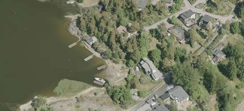
The objective is to amend the property boundary of the block area to include the expropriated alluvial area. An alluvial area is a former water area that, due to reclamation, a drop in water level or overgrowth, has permanently become a dry land area.
In the early 2000s, the alluvial area was expropriated into the property. However, the approved 2009 plan did not take new property boundary into account. All other items in the previous detailed plans will remain in force; there will be no other changes.
Shortened detailed plan process
The impacts of the amendment to the detailed plan are minor, which means that the preparations for it will follow a shortened detailed plan process.
The planning material will not be visible on the website during the preparation phase but will be communicated by letter to the parties involved, such as nearby neighbours. At the proposal stage, the plan material will be available for review on this page, and you can leave an objection about it if you wish.
If you have any questions or comments on the plan, please contact its planners.
Read more about the preparation and content of the plan on the project webpage in Finnish
For more detailed and up-to-date information, visit the Finnish site for the plan. You can also contact the planners for more information.
At the proposal stage, the plan material will be available for review on this page, and you can leave an objection about it if you wish. We will also accept feedback on the plan in English. The materials will be available on the Finnish site of the plan.
If you would like to be informed about the status and progress of the plan and opportunities for participation, please subscribe to the Have Your Say Now email newsletter in Finnish. It includes information on all current urban environment projects. The newsletter is released every two weeks. Subscribe to the newsletter.
You can keep up with the processing stages and decision-making of the plan through the City of Espoo decision-making system. In the search field, type the area number of the plan, which you will find at the top of this page. Open the decision-making system (in Finnish)(external link, opens in a new window).
Learn about planning and participation
You can read more about the process of detailed planning and resident participation on the page Detailed planning process in stages.
Read more about participation in planning from the page Participation is part of city planning.
Paltsa Salama
Detailed Planning Engineer+358 40 1882395paltsa.salama@espoo.fiTekniikantie 15, Otaniemi