Product descriptions for geographic data and maps
Geographic data is data that includes location as one of the characteristics. Geographic data also includes data on other characteristics. This data is stored in official registers maintained by the city.
Product descriptions
We provide up-to-date maps, excellent geographic data and high-quality products for planning, building and business purposes.
Our products meet each customer’s needs and the quality requirements laid down in laws and regulations. We cooperate with the other capital region cities and other regional and national organisations. Our data is regionally compatible thanks to the coordinate system and harmonised height system. In Espoo, we use the projected coordinate system ETRS-GK25 (EPSG:3879) and the N2000 height system.
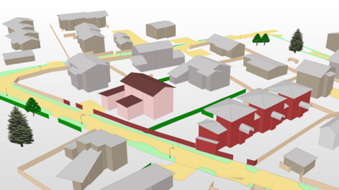
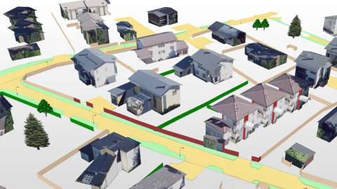
All our maps are digital, and 3D models are part of our everyday work. In a 3D model, geographic data is shown in three dimensions, instead of a traditional map view. We have actively developed the production and distribution of Espoo’s 3D city model, targeting it at the widest possible range of users. The model can be viewed through the online map service(external link, opens in a new window). Our 3D city model received an honourable mention in the 2019 Quality Innovation Awards competition. We are also involved in the development of 3D models.
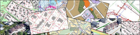
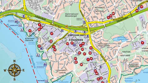
We are responsible for the city’s base map, map of underground pipes and cables, guide map, cadastral map and combined detailed plan map, and we also provide special maps. We provide our customers with maps for planning purposes and sell and distribute other types of geographic data and printouts. We produce some of our material together with the city’s other units.
We have both external and internal customers, and there is a clear need for our products. We develop the content and use of our products together with our partners. We take our customers’ new needs into consideration and respond to them in order of priority. We take technical developments into consideration as we examine the effectiveness of our production methods and practices and possible development needs.
We support the development and introduction of online services. An interface service is a programme that serves a user’s own geographic information application by providing information based on searches. The interface software we use complies with the international standards for geographic data.
We have a group of skilled employees working with geographic data, and we always deliver products to our customers in accordance with the agreed schedule.
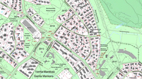
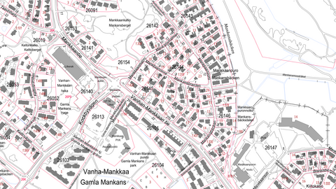
The city’s base map shows all elements that are important from the perspective of planning and construction, including properties, buildings, traffic routes, bodies of water and elevation information.
The base map is an accurate map of the entire city, and it is used in connection with city planning and when preparing site plans for building projects. It is also used as initial material for 3D planning. The planners of building projects can also utilise material produced through laser scanning, which is very accurate in Espoo. The base map is also used when producing special maps.
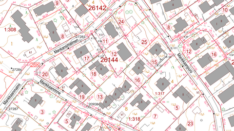
Geometric objects on the map include register data. For example, buildings include information on roof structures and building materials, completion, heating methods and other properties.
The data used for planning purposes is regularly updated. New buildings larger than 30 m², changes in property divisions and streets meant for vehicle traffic are quickly added to the material. Other elements are updated in connection with additional mapping processes. Each year, some 5,000 hectares are remapped in Espoo due to changes.
Base map data is available for the entire city area, and you can use it through a geographic information or planning programme on your computer. Vector-based data is available in several file formats (at least XCity, Kunta and CityGML, SKP, DXF, DGN, DWG and MapInfo) as well as through WMS and WFS interface services.
You can also find the map through the online map service(external link, opens in a new window) in a 2D and 3D view.
Service for builders and planners: Buy a map online
You can buy the base map online. At asiointi.fi Store(external link, opens in a new window), you can buy the base map in DWG, TIF and PDF formats after selecting the desired area on the map. You can use the service if you have Finnish online banking codes.
Through the same website, you can find information on geotechnical investigations and soil as well as architectural drawings.
The service is easy to use, but you can contact us for advice if necessary.
Service for planners and enthusiasts: Utilise open data
Initial material for 3D planning is available as open data through a WFS interface. Read more about 3D city model of Espoo.
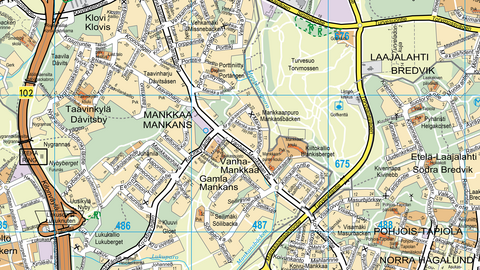
The guide map contains fewer details and is more general with emphasis on the street network, names and addresses. The map also includes Kauniainen.
The geographic data related to the guide map is available in vector and raster format. For professionals and others who have their own geographic information programme, the quickest way to access the guide map is through the interface services provided by the city. The map information is constantly being updated. The guide map is also used when producing special maps.
The guide map is also available as a printout that can be used as a wall map.
You can also find the map through the online map service(external link, opens in a new window).
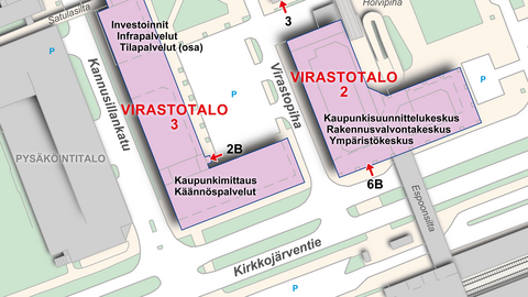
The cadastral map (known as the “office map” in Finnish) was originally created for public officials who needed a map in customer service situations. It is an accurate topographic map on which the content of the base map has been simplified.
The cadastral map includes the city’s land ownership and park areas as well as planned areas covered by a detailed plan. The map works best when viewed on a scale of 1:4000–1:5000.
The address map contains less information than the cadastral map. The map can be viewed through the city’s intranet, and the address map is also available through the online map service(external link, opens in a new window).
The combined detailed plan map contains effective plan symbols.

The combined detailed plan map is available in raster format and, upon agreement, partly in vector format. The symbols can be found in the plan regulations concerning the plan in question.
You can also find the map through the online map service(external link, opens in a new window).
The map of underground pipes and cables shows the exact locations of underground pipes and cables in areas owned by the city. This includes electricity, telephone and streetlight cables, sewers, water and district heating pipes etc.

Please note that the cable and pipe report needed for excavation work in the city’s area can only be obtained through our online service. You must submit your application no later than three days in advance. The processing time depends on the size of the area. At least one working day has to be reserved for preparing a report for a small area and at least three working days for larger areas.
Cable and pipe reports are only valid for two weeks from the date of issue. This is because the location of cables and pipes may change rapidly. The cable and pipe report and map are intended for single use and for the active working area in question.
You can apply for a cable and pipe report through the eLupa online service(external link, opens in a new window) (in Finnish).
Excavation in public areas, such as streets and parks, requires an excavation permit. You can find more information on the following page: Excavation permit and siting permit.
Further information: Cable and pipe information service
We produce special maps based on our customers’ needs.
Map templates
We use the guide map, cadastral map and base map as the basis when producing special maps. The base map is mainly suitable for small areas due to its detailed and precise nature.
We can remove unnecessary lines and symbols from the map and only leave the elements that are necessary for the intended use.
The scale of the map can be freely selected, for example depending on the desired paper size of the end product and the area in question. If a specific scale is required, it will determine the physical size of the product and the area shown.
Production
The map template is saved in pdf format through our up-to-date work database and further processed using the Adobe Illustrator CC software. We are more than happy to produce a complete map for the customer’s publication instead of just providing the basic material.
We also provide ready-to-print publications. The layout software we use is Adobe InDesign CC.
In addition to paper printouts, our material is available in vector format as AI, EPS and PDF files and in raster format as PNG, JPG, GIF and TIFF files.
Delivery methods
- email (maximum file size 10 MB)
- download from our server
- other method as agreed
Downloadable files
Examples of special maps we have provided:
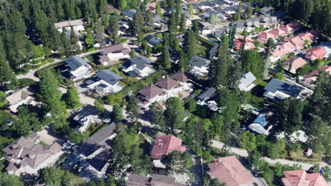
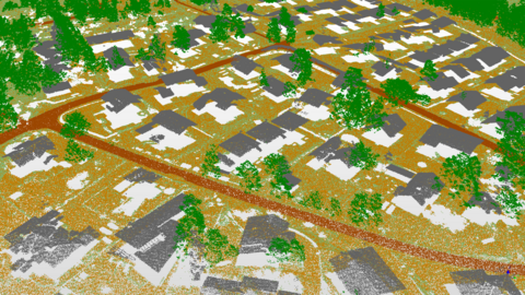
Laser scanning is a measurement method that utilises laser beams and produces three-dimensional point-like data, a so-called point cloud.
Espoo has been laser scanned in 2013, 2017, 2021 and 2024. Laser scanning is performed from an airplane and provides information on the ground, structures, buildings and vegetation.
The most common form of laser scanning data is a model that depicts the ground. Other classified point cloud data is also available. The data is available in LAZ, LAS and DWG formats. Through our online map service(external link, opens in a new window), you can download ground points from the 2013 and 2017 point clouds as open data and see the 2021 and 2024 point clouds in a 3D view. The map service allows you to view the point cloud with colouring based on aerial photographs, object classification or height.
The data has also been divided into files according to the capital region’s ETRS_GK25 map sheet division.
This section is intended for professionals.
For our external customers, we publish our material through standard vector and raster interfaces (WFS and WMS interfaces).
Thanks to our WFS and WMS interface services, up-to-date maps and geographic data published through Espoo’s geographic information system can be used in external geographic information applications, map windows and information system integrations. The interfaces have been developed in accordance with the OGC (Open Geospatial Consortium) specifications.
With the help of the WFS download service, it is possible to search for geographic features, i.e. geographic data in vector format (e.g. districts). 3D city model of Espoo is also available through the open WFS interface.
The WMS viewing service allows you to view maps, for example the guide map, in raster format (as map images). The open data available through Espoo’s interface services includes the guide map, districts and postal code areas.
More detailed technical description of interface services, contact information(external link, opens in a new window) (pdf, in Finnish).
Instructions on how to use WFS CityGML interfaces(external link, opens in a new window) (pdf, in Finnish).
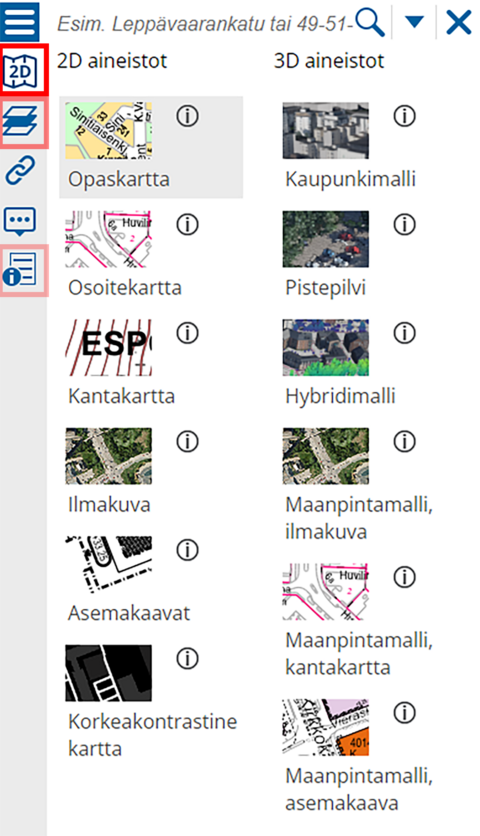
Through the online map service of Espoo(external link, opens in a new window), you can view most of the maps we have produced and download open data content.
2D content:
- Guide map
- Address map
- Base map
- Aerial photograph
- Detailed plans
- High-contrast map
3D content:
- City model
- Point cloud
- Hybrid model
- Terrain models based on aerial photographs, the base map or detailed plans
Open data:
- 3D buildings, LOD1
- Combined detailed plan map, tiff
- Terrain points 2013, LAZ and DWG
- Terrain points 2017, LAS and DWG
- Mesh models 2017
- INSPIRE, land use, spatial plan and zoning elements
Through the icon on the left-hand side of the map service, you can select your preferred map view. The next icon opens a menu where you can select what information is shown on the map. The options available depend on whether you selected 2D or 3D content. Further user instructions are available through the info icon at the bottom.
Downloadable files
Orders for maps and other data
Geographic data and map orders
+358 9 81625500karttatilaus@espoo.fiStreet address: Tekniikantie 15, 02150 EspooPostal address: P.O. Box 41, 02070 CITY OF ESPOO
Ilari Issakainen tel. +358 40 6393653